Tag Archives: MN North: Amity

Fall Colors!

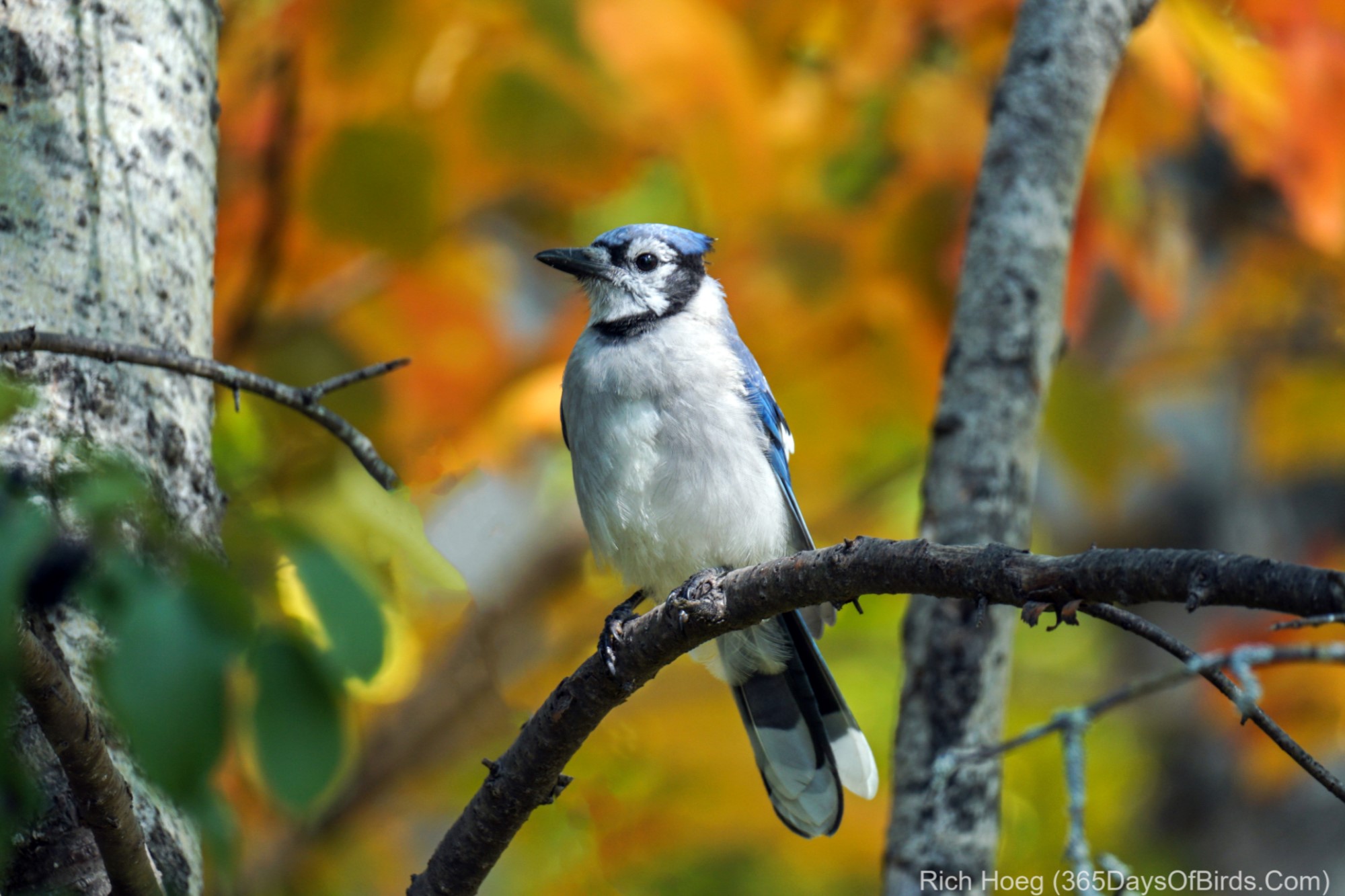
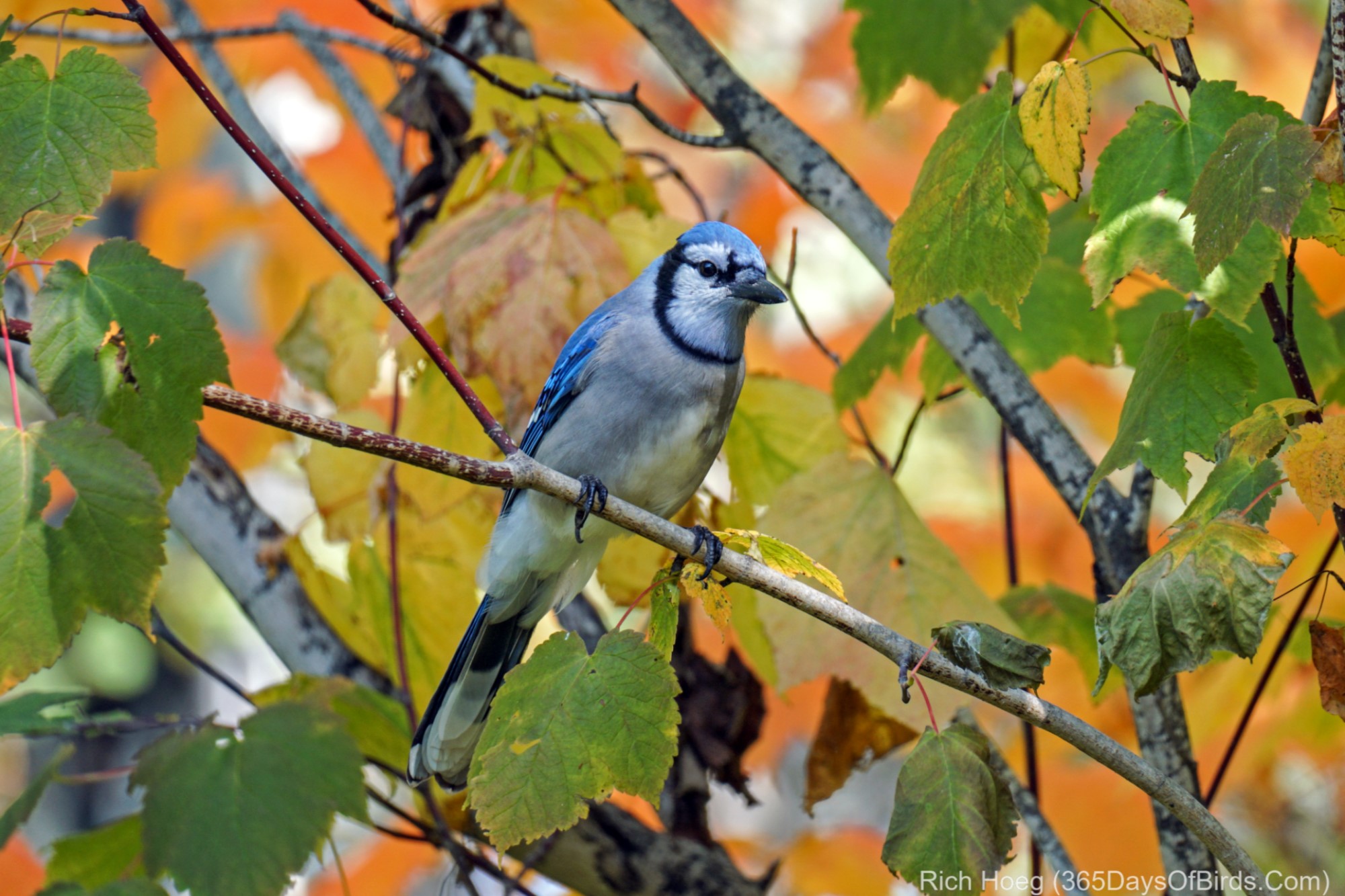
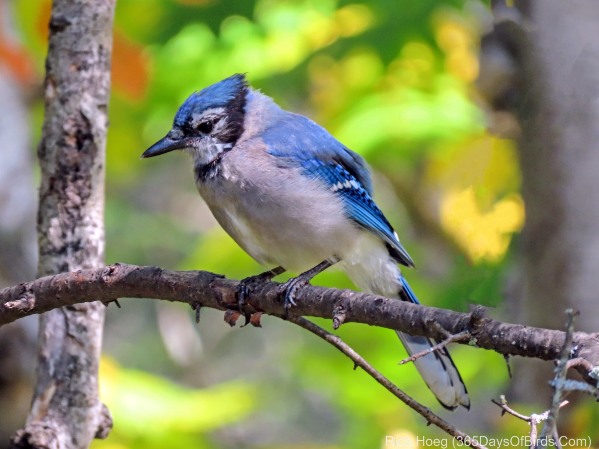
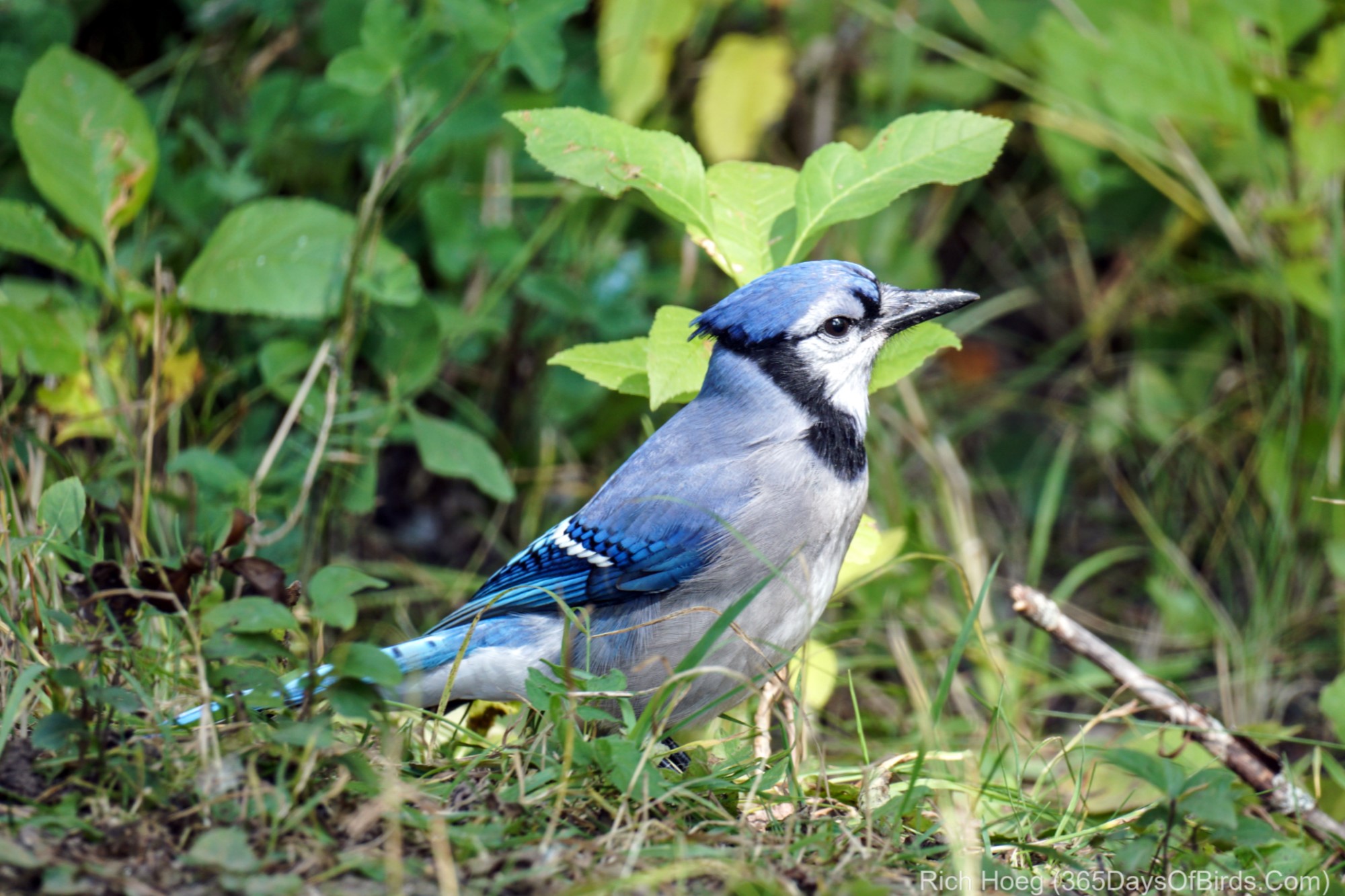
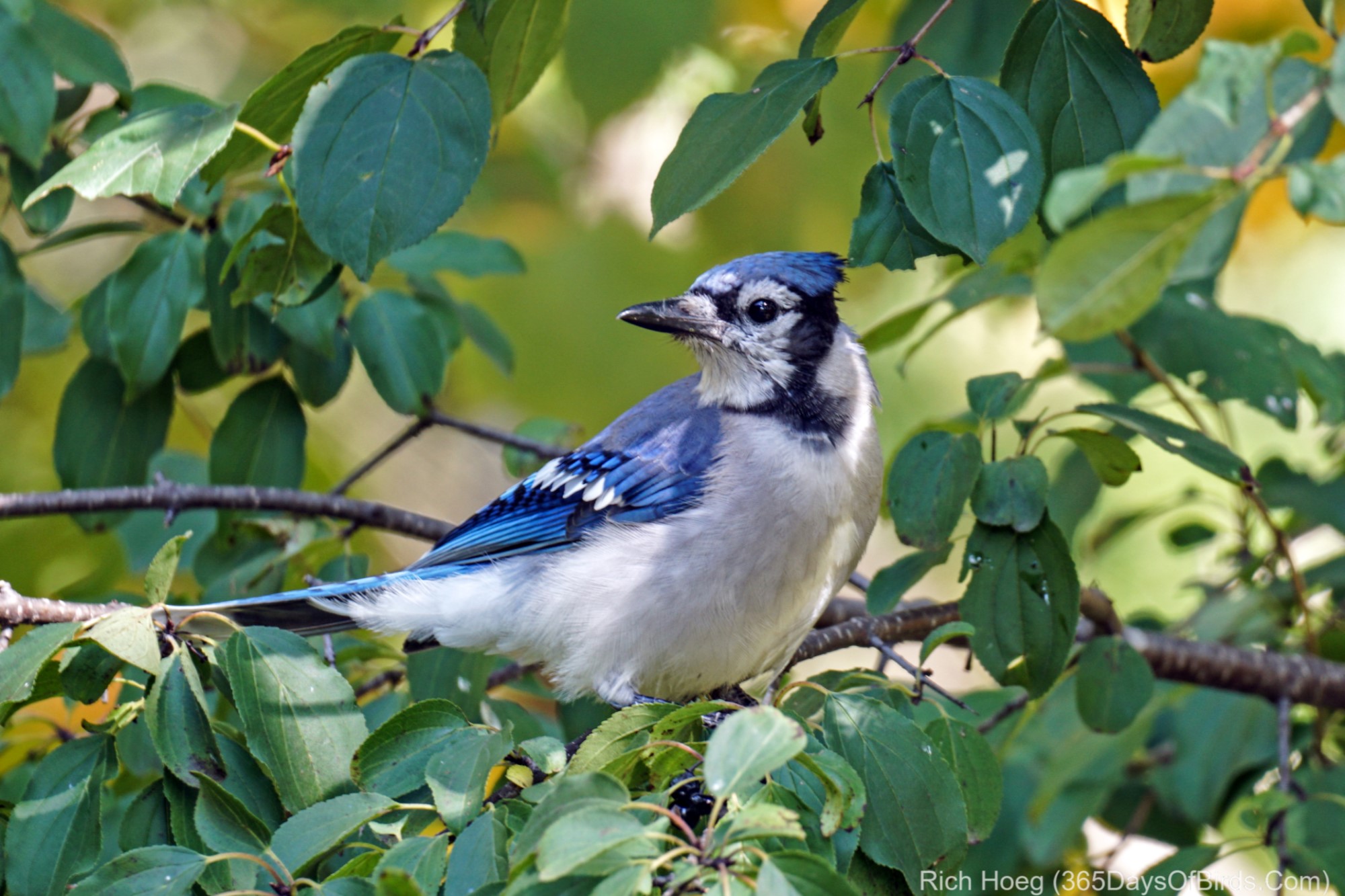
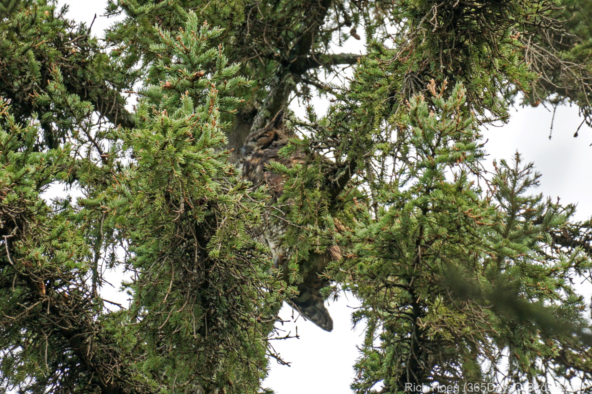
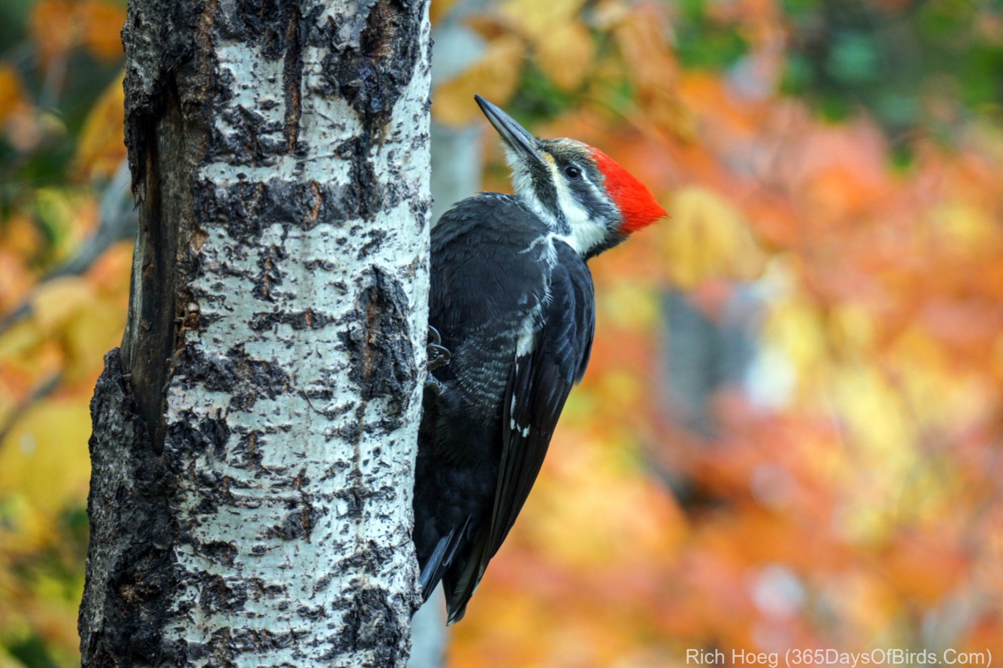
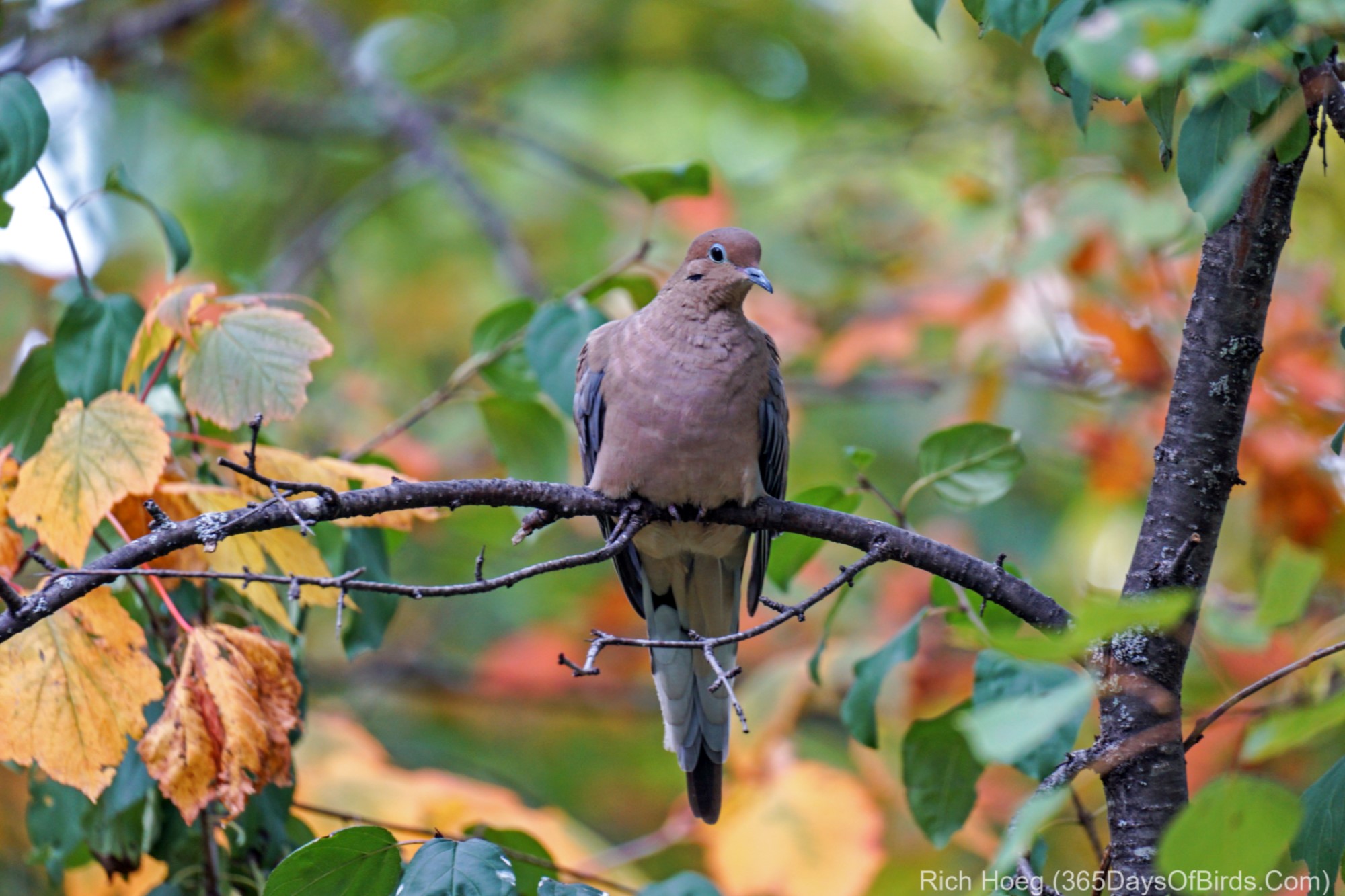
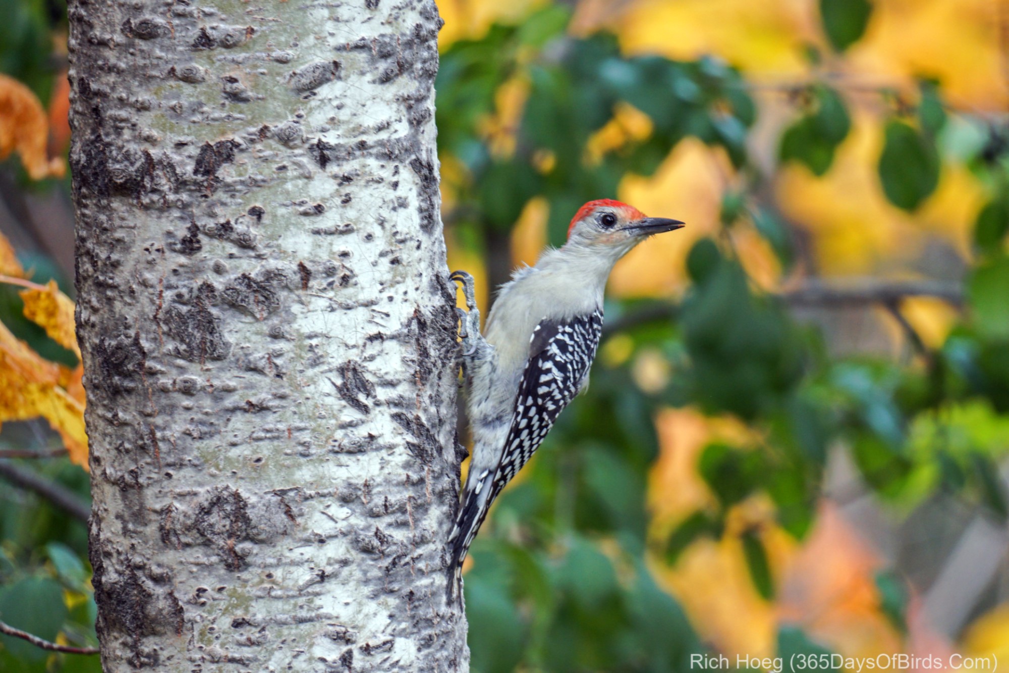
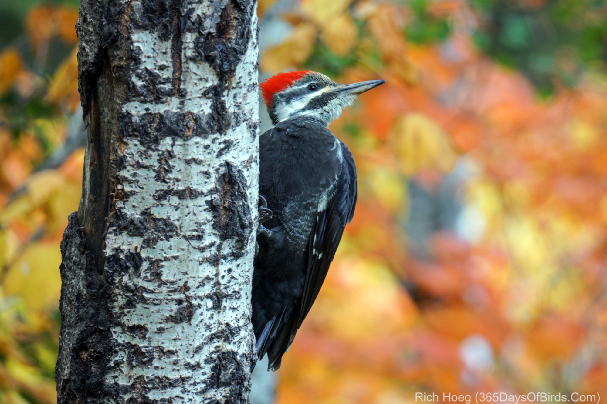
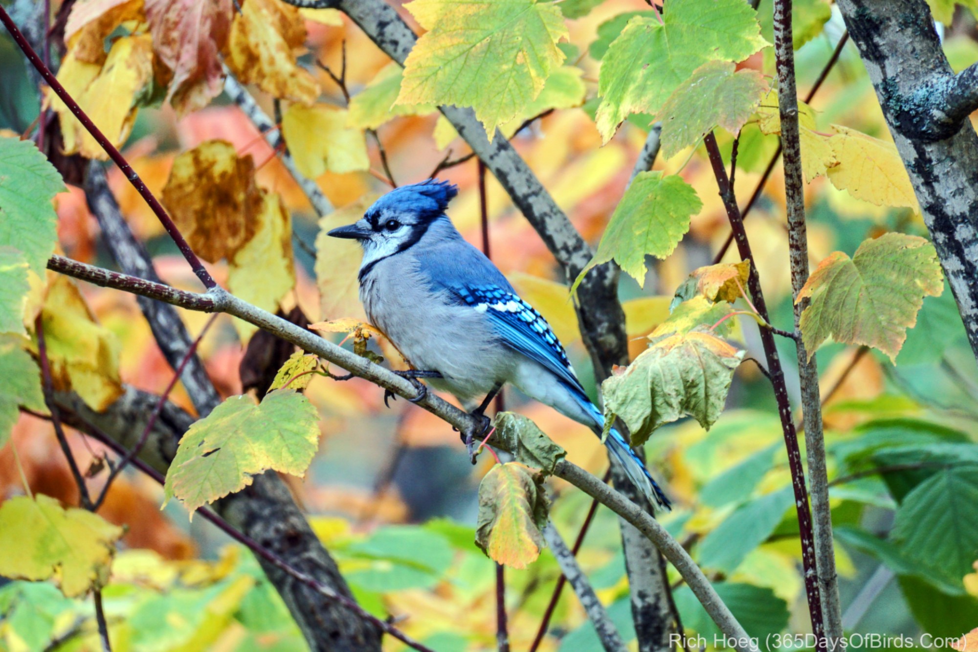
It’s nasty cold today … huge wind out of the NE off Lake Superior with some drizzle and clouds (50F).  In short, it is beautiful day to enjoy the Fall colors and photograph birds (and watch surfers on Lake Superior!). To take photos on a day like today one needs to push the ISO up, rely upon burst mode, and find birds. There is no shade or shadows to ruin an image, and colors are deep / intense.

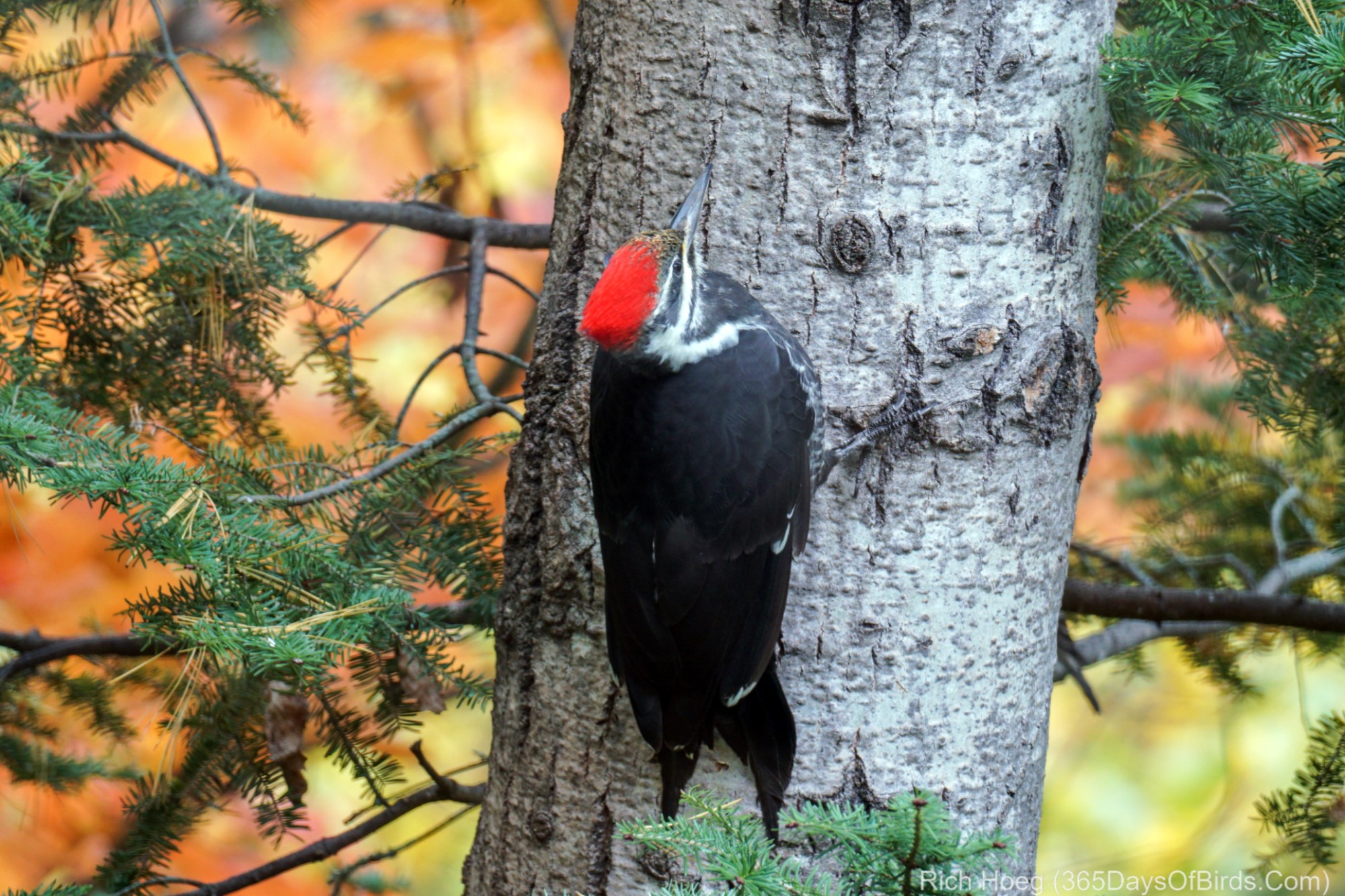
Today’s player include: Red-Bellied Woodpeckers, Pileated Woodpeckers, Mourning Doves and of course … old “Blue!”


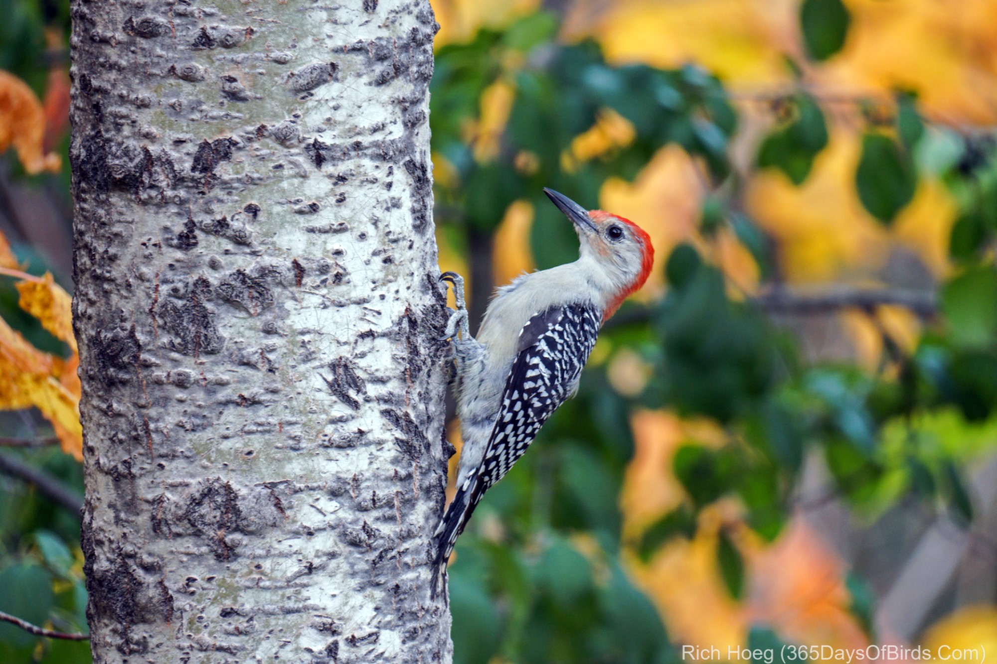
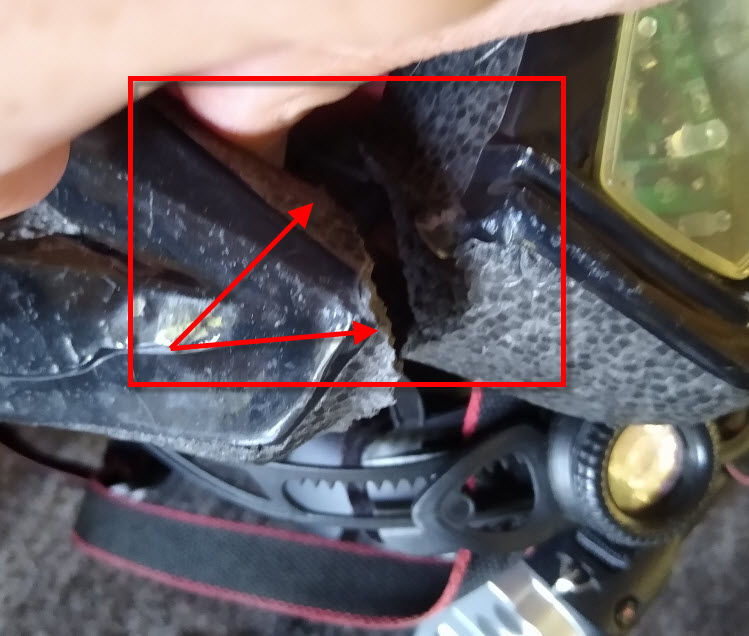
Now for a public safety announcement. Wear a helmet 100% of the time when cycling. Yesterday afternoon I had a nasty crash which resulted in road rash, a fractured rib or two and a BROKEN bicycle helmet. My Garmin which I always wear recorded I was motionless for over 12 minutes. Obviously I was knocked out for part of that time and received a minor concussion. The rest of the 12 minutes was spent sitting, stunned, next to the road. If I had not worn my helmet, I might not be creating this post.  It was very strange to wake up … stretched out on the ground and be staring directly up into the faces of two walkers. For 15 minutes I could not remember what had happened, or where I was … I just knew I hurt.

My bicycle helmet showing the crack right behind my temple area. Be safe!

48,056 Blue Jays Can’t Be Wrong!

The word is out … good sunflowers seeds and cracked corn at Richie’s Bar and Grill (fine bird dining in the Northland since 1956). Yup! The official Hawk Ridge Count for this migration season as of a few moments ago is 48,056. My home is about 4/5 of a mile (and 600 feet down in elevation) from Hawk Ridge. During September and October, the staff at Hawk Ridge count birds from the viewing platform. The hill over Lake Superior is one of the top locations in mid America to get a first hand seat at the bird migration. This year’s Blue Jay numbers are epic.

Given my location near the base of the ridge, it is a constant blue parade at my feeders. Now that fall foliage is almost at peak, the colors are glorious.

Fall Colors as seen from deck this morning.

Yesterday the sunrise was eerie in Sax-Zim Bog. The smoke from the western wildfires was quite evident (God Bless all those folks dealing with that horrible situation). My vantage point for this image was on Sax Road looking back towards Hwy #7 and the RR tracks.

Advance Planning Photography

How does one get the shot? In my case my goal is to photography the Milky Way just a few thousand feet from the Canadian Border of Minnesota in the BWCA. The answer to the question is “advanced planning’. While I have never been in the exact location where I intend to visit late tonight, I have seen it “in my mind” and using online tools. Today’s post will walk you through the thought process behind my planned photograph. Tomorrow’s post will show you the result … good or bad. (see the results!)

My tools for this planning session are Google Maps (normal and satellite view), the Android App PlanIt Pro, and a Lunar Moon Phase App.

First … a screenshot of Google Maps Satellite View. I am located at the red pin maker.


Still using Google Maps, I zoom in using Satellite View. While I am staying at Gunflint Pines, I know the Milky Way is in the SW sky this time of year. For my photograph I want water, preferably calm water for reflected stars. Using Google Maps I zoom in and out looking for views to the southwest.


My Android App notes the skies where I am located at truly dark … a number 1 rating.


My research via Google Maps found the Cross River at its outlet from Gunflint Lake. Further research via PlanIt Pro gives me the exact location of the Milky Way at 10:06 pm … about 2 hours and 20 minutes after sunset. Normally, true darkness starts two hours after sundown. This location looks to give me water for reflected stars, and protection from any wind. We shall see. Remember … although I have spent a reasonable amount of time on the Gunflint Trail over the years, I have never been to this exact location.


Just providing a more zoomed out screenshot which will help folks better understand my location.


Finally a quick check of the Lunar Phases Map. The moon will not be an issue at 10:15 pm, and really all night … 21% illumination is not too much.


Anyhow … you now have an idea of my advanced planning which goes into tonight’s Milky Way photograph. Results tomorrow!

Oh yes … this is a blog about birds! I found one of my Great Horned Owls this morning about 7 am. For the past two weeks I had not been able to find any of the owls, nor have I heard the youngsters begging at night (was an almost nightly occurrence during July and August). I am beginning to wonder if the juvenile owls have finally been kicked out of the parent’s territory (normal).

Regardless, the owl was way up high, sleepy, and not open to much of any decent photographs.